
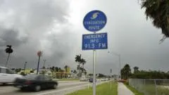
Why is the 2026 Atlantic hurricane season facing a historic lull?
The 2026 Atlantic hurricane season is currently on track to potentially become the first season in the satellite era without a single hurricane. This possibility arises because no hurricanes formed during September, a month that typically serves as the peak for tropical storm and hurricane activity. This marks the latest date on record since the start of the satellite era in the 1960s where such a void in hurricane formation has been observed in the North Atlantic.
While the absence of hurricanes is striking, the month was not entirely devoid of tropical activity. Four named tropical storms—Edouard, Fay, Gonzalo, and Hanna—did develop during September. However, the impact of these storms was limited; with the exception of Edouard, these systems remained over the open waters of the Atlantic. As the season moves toward its conclusion on November 30, the window for hurricane development is narrowing, making a completely hurricane-free season an increasingly plausible scenario.
Historical Context and Data Gaps
To understand the gravity of this trend, one must look at the historical Atlantic hurricane database. The records indicate that there has not been a year without a hurricane recorded since 1914. However, meteorologists caution that this record is subject to technological limitations. Because the 1914 data predates the satellite era, it is impossible to state with absolute certainty that no hurricanes formed during those years; they may simply have gone undetected by the monitoring technology available at the time. In contrast, the current era of satellite monitoring provides a much more reliable baseline, making the current lack of activity even more notable.
How does El Niño suppress Atlantic hurricane activity?
El Niño is the primary driver behind the current suppression of Atlantic storm development. While El Niño represents the natural warming of the tropical Pacific, its influence extends globally by altering atmospheric circulation patterns. In the Atlantic, this phenomenon manifests as an increase in upper-level winds, which leads to an increase in wind shear.
Wind shear occurs when wind speeds and directions change rapidly at different altitudes in the atmosphere. For a tropical disturbance to organize into a hurricane, it requires a stable, vertical structure. Strong winds at higher altitudes act as a mechanical force that can literally rip apart developing thunderstorms. By disrupting the vertical alignment of these storms, El Niño prevents them from growing into tropical storms or intensifying into powerful hurricanes. This year, the influence of El Niño is expected to be particularly strong, with forecasts suggesting it will continue to strengthen and reach its peak in November or December.
What is the impact of El Niño on the Pacific hurricane season?
In stark contrast to the quiet Atlantic, the eastern North Pacific is experiencing an exceptionally active season due to the same El Niño patterns. The warming of the Pacific sea surface temperatures provides the thermal energy necessary for rapid storm intensification. This year, temperature records have already been broken in a key region of the central-eastern Pacific, with daily sea surface temperatures now exceeding the previous record set during the very strong El Niño of 2015.
The Pacific has seen significant activity, with 17 named storms recorded so far, including nine hurricanes, seven of which reached major hurricane status. The energy levels in the Pacific are also significantly higher than average. When measured by Accumulated Cyclone Energy (ACE)—a metric used to quantify the total energy produced by tropical cyclones—this season in the Pacific is approximately two and a half times more active than normal at this point. This surge in activity is supported by both the warmer waters and more favorable wind patterns characteristic of El Niño.
What are the official forecasts for the remainder of the season?
Meteorological agencies have maintained a cautious outlook for the Atlantic throughout 2026. In May, the US National Hurricane Center (NHC) predicted a relatively quiet season due to the strong El Niño forecast, estimating a total of eight to 14 named storms. Of those, they projected only three to six would become hurricanes, with one to three reaching major hurricane status.
Current observations align with these early projections. Forecasters at Colorado State University, who also monitor activity, suggest that the persistent El Niño is likely to continue disrupting wind patterns across the Atlantic. Their models indicate that this will likely result in below-normal activity over the next two weeks. Currently, the NHC suggests there is no sign of any tropical storm activity or hurricane formation over the next week at least. As the typical peak of the season has passed and is now on a downward trend until November 30, the possibility of a season without a single hurricane grows.
Summary of 2026 Seasonal Projections
| Metric | NHC May Forecast | Current Atlantic Status |
|---|---|---|
| Named Storms | 8 to 14 | 4 (September) |
| Hurricanes | 3 to 6 | 0 |
| Major Hurricanes | 1 to 3 | 0 |
As the season enters its final two months, the focus remains on whether any late-season systems can overcome the high wind shear to reach hurricane strength before the typical downward trend concludes in late November.
Frequently asked questions
Can El Niño cause both quiet and active hurricane seasons?
Yes, El Niño affects different ocean basins in opposing ways. It typically suppresses Atlantic hurricane activity by increasing wind shear, which disrupts storm formation. Conversely, it enhances Pacific hurricane activity by providing warmer sea surface temperatures and more favorable wind patterns that allow storms to grow more easily.
Why is September considered the most important month for hurricanes?
September is traditionally the peak of the Atlantic hurricane season. During this month, ocean temperatures are typically at their warmest and atmospheric conditions are most conducive to tropical development. This is why the current lack of hurricane formation in September is considered a significant historical anomaly.
What is the difference between a named storm and a hurricane?
A named storm is a tropical cyclone that has reached sustained wind speeds sufficient to be given a name by meteorological agencies. A hurricane is a more intense stage of a tropical cyclone, characterized by much higher sustained wind speeds and a more organized structure.
How does wind shear prevent a storm from becoming a hurricane?
Wind shear involves rapid changes in wind speed and direction at different heights in the atmosphere. These winds act to tilt or physically blow the top of a developing thunderstorm away from its base. This prevents the storm from maintaining the vertical structure required to intensify.
Is it certain that no hurricanes will form this year?
It is not certain, but it is increasingly possible. While the Atlantic has not had a hurricane-free year since 1914, the current lack of activity in the peak month of September and the presence of strong El Niño-induced wind shear make a hurricane-free 2026 season a distinct possibility.
Key takeaways
- The 2026 Atlantic hurricane season may become the first in the satellite era without a hurricane.
- September 2026 marked the first time since the 1960s that no hurricanes formed during the peak month.
- Strong El Niño is driving high wind shear in the Atlantic, preventing storm organization.
- The eastern North Pacific is seeing record energy, with activity 2.5 times higher than normal.
Conclusion
The 2026 Atlantic hurricane season represents a remarkable meteorological outlier. The interaction between a strong El Niño and the Atlantic atmosphere has created an environment where wind shear effectively stifles tropical development, leading to a historic lack of hurricane formation during the season's most critical month. While the Pacific basin experiences a surge in energy and storm frequency, the Atlantic remains uncharacteristically quiet. Whether the season concludes without a single hurricane will depend on the persistence of these El Niño-driven wind patterns as the season moves toward its November conclusion.